Sunday, August 22, 2010

TAT Report 2010-Day 11 & 12 August 19-20-2010- FINAL CHAPTER

Greetings...

Thursday morning I made contact by phone with Steve W. (The rescue truck driver). He had made it West of Dayton on his first day, and was on the move again. I did some quick figuring, and determined we'd end up meeting East of St. Louis, MO about noon.

This would put us about 45 miles East of St. Louis, at Exit 45and Rte 127. My calculations were off a little, as we arrived there about 10 minutes before Steve.

No shade at "High Noon", so we found a roomy parking lot adjacent to Mickey D's, and loaded the bikes on the trailer as soon as he arrived. After that we went inside for a quick lunch and more liquids ( 90's again).

Pretty uneventful riding the "big-roads" (Interstates). Did spot one neat place I would have liked to poke about at, Bobs Gasoline Alley,( http://www.route66pulse.com/pages/articledetailsarch.asp?cat=62&art=680&iss=14 )

Also a nice cruise in report from local Corvette club that went to Bob's, (http://www.vintagevettesoftheozarks.com/bobs_gasoline_alley_cuba_mo.htm ).

We made it back to Dayton, OH  for the night, stopping at a Cracker Barrel along the way for dinner.

Friday  AM we loaded ourselves into the rescue truck, and made it home by 4:30PM for Brooks, and I was home by 5:30PM.

Had a note from Jon's wife yesterday (she's our weekend mail carrier) that Jon made it okay, getting in about 10:30PM Fri. night.

Have a call into Rich to check his location and condition, so all will be accounted for.

SUNDAY:

Got a call about 3PM today (Sunday) from Rich. He got home late last (Sat)  night, before all the rain hit. Turns out he played  around on the back roads in WV, then started North. He put in a call for wife Carol to start South West with his truck and trailer, and they met Sat afternoon near State College, PA. Loaded up, and come on in to home last evening. His foot is still sore and tender. He will attempt to see the doctor this week for a real examination.

Rich sent me a picture. Guess this explains why he called for the rescue truck. Makes for a long slow ride home on one of these old Vespas.

Looks like this about wraps it up. Wish we were still riding Westward, but it will just have to wait till next season. We had a great time, met great and interesting people, saw some wonderful sights, experienced some very HOT weather, and we learned something new everyday. Never a dull day, always something new and different. Oh, almost forgot. We found and sampled some great little eateries along the way, sampling some great local catfish, hush puppies, okra, and Mexican food. 

Thanks also to the "followers" of this little blog. We enjoyed having you along to share the "ride".

Sincerely,

Doug
Brooks
Rich
Jon

Rich on new found "bike" Maybe an audition for Wild Hogs?

Wednesday, August 18, 2010

TAT Report 2010-Day 10 August 18-2010

Wednesday already.
We have now spent two nights in the same motel....BORING....especially when you're handy-caped. We ordered out last night and had Chinese delivered to the motel...it was filling.


Small quiet and  clean..this is the Econo Lodge where we "hid out" for two days, planning our escape.


We were in the back building, just about had it all to ourselves. Horses at the ready to make our escape, at a moments notice, when the time was right.


Decision was made this AM, we'd start for home. My ankle felt a lot better, but was obvious I'd never get all my strength back in time for the Rockies crossing, and could actually make matters worse by not getting the needed rest on it if I kept riding Westward. I called my friend back home. He will pick up my trailer at Rich's place, and head towards St. Louis, MO. We'll head towards St. Louis also.

We got a late start, maybe 10:15am, and headed East on 60 from Bartlesville. We connected with I-44, and headed towards Missouri.  Just as we entered I-44 (a/k/a Will Rogers Parkway), I saw a motorcycle headlight behind us. It just stayed back there, maybe a third of a mile. It traveled at the same speed as we did, about 60 mph (speed limit 70mph). After about 100 miles, we pulled into a rest area / information center. Just as we pulled into the parking spots, this bike that had been behind us, pulled in beside us. It  was a cute little Honda Rascal (250cc), all decked out. This small, almost frail elderly gentleman got off. He immediately started up a conversation. Within seconds I learned he was 75 years old, had been riding 55 years, had retired his original CB750 (Honda), as it got bigger and heavier as he got older. We all walked into the rest area facility.

Rich...you would have loved this guy...he even kept talking when we were in the mens room, standing facing the wall....doing our thing.

After washing up (Brooks had to show him how to turn on the "magic" facets) (the auto sensor type).
we went into the information section, got a new map, free (Hey..CB..you hear that .. FREE coffee), sat down and relaxed.

I know know his name is Mr. Cain, and he lives in Eastern Missouri, born and raised there.
Not sure how we got on the subject, (other than he mentioned it), but at one time he delivered new and used airplanes to customers all over the US. We learned of the time he delivered a 1923 British Sopwith Camel Bi-plane to a rancher in South Dakota. No navigational equipment in those old planes. You flew with a chart (map) strapped to your thigh, and you had a compass and a stop watch.

Read more about this great old plane:   http://en.wikipedia.org/wiki/Sopwith_Camel

I mentioned we lived near a place called Hammondsport, NY, birthplace of Glenn Curtiss.
He immediately started telling me about Glenn Curtiss and his competition with the Wright brothers. He knew what he was talking about. His historical facts were right on.

Read more about Glenn Curtiss:  http://www.glennhcurtissmuseum.org/


Eventually I finished my coffee, and we started back outside, Mr. Cain right at our side, never missing a beat.

We said our good-byes, and we were off.  What a neat (and nice) guy he was....Rich said it, we meet the nicest and most interesting people on our motorcycles.

Mr. Cain 75 years old-enjoying life everyday


We kept on a movin...finally stopping just outside Rolla, MO. A wonderful Best Western.  Guess what...FREE coffee in the rooms. A whole basket full of pure Colombian coffee. I took a picture of it and will print it out when I get home...guess who's going to get it in the mail...yep..Mr. CB...in Beebe, AR.

FREE Coffee- What a neat idea

Gave Jon and Rich a call tonight. They are bunked down near Lexington, KY. They had a good day, traveled over 325 miles. Rich even got a tire to replace his almost bald D606 rear. Said he paid $10.00 for it.
I told him he must have gotten it out of a dumpster. Turns out he found it at a bike parts shop they drove past. Used, but for $10.00, you can't go wrong .

We'll continue in the morning. We expect to meet our rescue truck about 11:30-12 noon, on I-70, in Indiana.


Stats for the day:  274 miles, avg speed; 56mph Time: 7hr 12 min

Tuesday, August 17, 2010

TAT Report 2010-Day 9 August 17-2010 Jon & Riches good-bye message

Not much to report...went to the hospital this AM and had my ankle x-rayed. Nothing broken, but severe sprain. They put a big, black, ugly boot on my foot, to immobilize the ankle. We will spend another night here in the motel, and make some decisions in the AM. If I decide I can't continue, (I have to be able to stand on the foot-pegs of the bike, especially in Colorado)...I have someone who can drive my truck down here and get us and our bikes. More tomorrow

---------------------------------------------------------------------------------------------------------------
I asked Jon & Rich to say something to our followers reflecting their feelings and experiences of the eight days they spent on the TAT.  Rich gave me a verbal statement as his response, and said I'd be able to paraphrase it satisfactory  Jon must have thought it was a homework assignment, and wrote me a response. I will transcribe that response now;
----------------------------------------------------------------------------------------------------------

      Many things come to mind that make The Transamerica Trail unique and memorable to me.The first thing is the remoteness of much of the area traveled.You can travel for miles without seeing any vehicles, or in many instances any homes or people. When you do see people, most are very friendly and wave at you as you go by.The local people and merchants have become aware of and positive towards the riders as more and more riders use the trail. We even ran into two instances where store owners are keeping a log book for riders to sign into as they pass through town.

     The scenery is diverse and can be very beautiful. Looking down from the top of the Ozark National Forest is a sight n I will never forget.

     Riding every day is challenging, as the conditions are always changing. this has helped to sharpen my riding skills. I know the practice we did before the trip helped when I started doing things by reflex rather than having to think about how to react.

     All in all, traveling The Transamerica Trail is not for everyone. If you enjoy challenging conditions, meeting interesting and friendly people, and seeing beautiful unspoiled countryside, then riding "The Trail" is for nyou.
I'm glad I was able to ride part of it (Tennessee to Oklahoma) and hope to be able to do more in the future.

Jonathan Gage- Canandaigua, NY- 8/16/2010
--------------------------------------------------------------------------------------------------------

    Rich's observations and feelings are very similar. He enjoyed seeing rural America and meeting the local people the most. The small towns with their unique gas stations, restaurants and people were a big part of the trip for him. Even getting separated and somewhat lost one afternoon, turned into a memorable experience when Rich stopped at a very rural cabin in the Ozark National Forest. The elderly gentleman immediately wanted to share his place with Rich, and gave him a tour and complete history of the property. He gave him the needed directions to get out of the mountain and into Clarksville, and wished him God speed. Rich then proceeded to travel the longest six miles, on the toughest road he has ever ridden, but made it to the hard road and to the motel, happy for his new found experience.

     Riches one impression of the rural areas he feels strongly about, is how important it is for this generation and future generations to properly care for and preserve this great treasure given us. It is apparent our fore-fathers weren't always the best stewards of the land. It has to be preserved and respected or it will be lost forever.

     Rich said he wished he could continue with us, as each day the trip got better and better.

Richard Joki- Prattsburg, NY- 8-16-2010

. --------------------------------------------------------------------------------------------------------

Break-time in the forest. Off to the reading room we go....


Break time in the mountains- Is that a traveling Nome sitting on the rock under the shade tree?

Monday, August 16, 2010

TAT Report 2010-Day 8 August 16-2010

Today  was sort of sad. When we got up this morning, we had our last breakfast with Rich & Jon. They are both heading back home today, as Brooks and I venture Westward.

 Left- Jon (a/k/a Little Jon ), also we've learned, he's known as the Traveling Nome,  say good-bye this morning, as we load up.
Rich (a/k/a Columbus) says he had a good time, and learned a lot.
Both Rich and Jon did a great job riding. Neither has a lot of recent dirt experience, and they both did great.


They will be taking mostly secondary roads back to NY and should be in MO tonight.


Brooks and I headed out, and were soon on some beautiful "back-roads". Billy Goat Hill Rd. comes to mind as a great one this morning. Clear  blue. cloudless sky's, low 80's, and a 10mph breeze from the East kept the dust from the bikes out of our eyes.

First water crossing in OK, easy, non-slippery


The roads changed to wonderful 2 tracks..what this means is if you have grass in the center, they are less traveled roads, and seldom need grading. If they get graded, the grass gets removed in the process. They are some of the best dirt/gravel roads to ride.


Crossing over Lake Hudson. On the map, looks to be about a half mile wide, and several miles long.

In Oklahoma???

The farms we've seen so far are really quite nice. Many nice horse farms. The area is much greener than I expected.

One type of farm we saw a lot of in AK, and again here in OK is the chicken farm. Quite often you'd smell it before you saw it. Huge barns. The type where 1000,000 chickens would be kept. I saw many farms with TYSON signs on a fence post. This I assumed shows they are  a contract grower for Tyson chicken.  Never did see a Perdue sign.

Where is Frank Perdue ?

Anyone know what this means?


When a farm (mainly poultry) is posted like this (other versions also), it means people have to be sanitized before going onto/into the property. Special boots, special jump-suits. Walk through a shallow pan of disinfectant, etc. There are several diseases that if carried into a poultry farm,can spread and wipe out an entire farm.

You know there will be a test at the end of this blog, don't you?

Time to finish up for the day.

We  were doing quite nicely, then got off the route a little. There came a time I went to get back on my bike, and my left leg, knee, or ankle gave out, and I fell straight down, folding my ankle under "all that weight" of me.  I managed to get on, nothing broken, but very well sprained. We got back on the trail, and traveled for another hour, but decided we'd shut down early and get some much needed rest.

We got off the trail, and came into Bartleville, OK (40 miles  due North of Tulsa).  Found a nice clean Econo Lodge, and even ordered a pizza delivered. I lay here with a bag of ice on my ankle, hoping I can ride tomorrow...we'll see.

Stats for today: 127.9 miles  36.9 avg mph, 5hr 35min

TAT Report 2010-Day 7 August 15-2010

This morning in Clarksville, we awoke to 81 degrees, and somewhat overcast skies. Looking to the South, you could see rain passing through the mountains off in the distance. The hill behind the Quality Inn blocks our view to the North. We have to backtrack about 22 miles on Rte 21, and pick up the "trail" where we left off.

We pulled out about 8AM, and had a couple quick stops to make before all meeting at the trail.

Rich (Columbus the explorer) had seen some sights downtown on Main st., he wanted to share, so I followed him down there.First was a business that looked like the side show to a circus. When he came by there after dark last night on his way back from dinner at the sportsman's club, he said people were lined up to get in.Rich said it was really busy.


 Expected to see the Fat Lady or Ripley's Believe it or Not


He missed his "Calling"
How can you pass up an old drug store named Teeters?


The local jeweler Phil has an historic clock out front.


Next stop was an old independent motorcycle repair shop. In the front window was an original Honda CL175


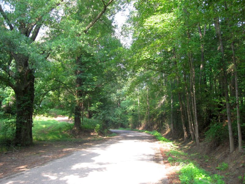
We met at the "trail " head, and started westerly, back into the Ozark National Forest.

The dirt, gravel roads were quite dusty, and we strung out fairly quickly. It wasn't a half hour into the ride, and I came around a corner, and saw an old store. I immediately recognized this from seeing pictures of it, and reading about it in other TAT riders ride reports. It was a must see place for me, so I stopped. I told Rich and Jon they could continue if they wanted to, but neither wanted to miss the old store.


Inside was truly a step back in time. The interior was pretty much 1890's style. The walls were decorated with wonderful, original antiques, old pictures, and memorabilia.


Just one of the "Folk Art" Roosters 3 feet tall

We had some coffee and water, and talked to the ladies running the place. Both lived there in the "mountains", and had been working there for years. The former owner walked in, and greeted us. Mr. James Mitchell had recently retired, and operations were now in the hands of his son James II and his wife Carla.
Mr.  Mitchell said the TAT riders were his most regular (except locals of course) customers. He produced a TAT guest book, which we of course signed. He said the riders even come through there in winter.

Over by the register were some pictures hanging. One showed three TAT riders on their bikes, in front of the store. SNOW on the ground. Hard for us to imagine, as it was almost 90 degrees already, and only 10AM.

Mr. Mitchell also explained he and his son had spent almost three years building a traditional log cabin on a hundred acre piece of land he owns, about 6 miles "up the mountain". The cabin has all hand hued logs, and is equipped with all modern conveniences, including a microwave. A loft sleeping area, and a couple bedrooms, plus a fold out twin couch, provide sleeping for several. He says he rents it out to TAT riders. They stop in at the store for a meal, learn about the cabin, spent the night, then come back to the store for a hearty breakfast, then hit the trail again. It gets $95.00/night for the cabin, and it even has a bike washing pad. His plans are to build two more cabins to accommodate the TAT riders and hunters in the area. Wish we had had time to go up and see it, but we didn't. Had to keep moving.


After leaving the store we continued on what proved to be a delightful narrow, smooth paved road that twisted all over the place as it snaked up the valley floor. Eventually we made a right hand turn onto a two track road that started to climb the mountain. Within a quarter mile it was "peg-time", as we rode 1st and 2nd gear, pulling an uphill grade around sharp turns as we went higher and higher. To call this road a jeep trail would be accurate. Very little else but Jeeps, four wheelers and dirt bikes could have made it. Once the steep climb was over, it leveled off somewhat, and the surface improved. We rode this section for a good hour, 2nd and 3rd gear, averaging about 20mph. We came over a small knoll, and saw a motorcycle stopped ahead. As we got closer, we could see it was Brooks. We soon learned he had been riding along and all of a sudden his rear tire went soft. Inspection revealed a small 2" long, rusty common nail buried into the casing. He had already pulled the wheel off, replaced the inner tube, and remounted it before we arrived. All that was left was to pack up the tools, and remount the bags and luggage. Practice at home changing tires had made the job on the trail quite easy. Of course it doesn't hurt to have all the proper tools along, including a small electric air pump.


So we're off again. Another half hour of nice smooth 2 track road, and we start down grade.

What was unusual was the roadway was littered with rocks that had been deposited there from recent rains and obvious flash flooding. These rocks were small at first, maybe 6 to 8" in diameter, but as the grade downward increased, it was apparent so did the force of the rushing water. There were stones as big as 30 to 50 lbs all over the place. This coupled with the ditches and paths the raging water had cut in the roadway made for some serious riding. No big adventure size bikes would enjoy this. We had arrived on the famed Warloop Road. We had read about this road in other riders reports. The road was getting worse and worse. My biggest fear  was it would get so bad, we'd get to a spot that was impassable, and we'd have to return to the top and find an alternate route off the mountain. As usual, pictures make things look better than they are.


We finally came out at the bottom of the mountain, crossed a bridge that was littered everywhere with washed down debris, logs, stones etc., and like night and day, we were on a paved road, leading 3/10th of a mile to a main road. It was time for a break. We saw a small roadside stand that was open, and pulled right in. We were in a community named Mountainside, and we were at the Mountainside diner.

I had, of course, a Mountain burger. This consisted of ground beef, loose, not in a patty. On this the appropriate dressings were added....cost? $1.35...(we're in the mountains). We found two picnic tables out back in the shade, and spent a restful time there before heading on.


By mid-afternoon, we entered Oklahoma. Mostly all "backroads" of gravel and reddish sand. A sign at a driveway advertised "Red-Dirt Excavation Co" . Many horse farms, cattle ranches, and large, green hay fields. It was decided we'd head off the trail and down to Tahleqah, OK and find a room for the night. It didn't look like much would be available for at least another hundred miles, and that was not an option in near 100 degee heat.  In Tahleqah (Capital of the Cherokee Nation), we found a beautiful Comfort Inn & Suites. (For only about $12.00/room more than CB's place in Beebe, AR, and the Quality Inn had everything. After showers, and cocktails, we walked over to Chili's for a nice dinner, and then settled in for the night. 


Stats for the day: 165   30.6 avg speed  ,  9hr 06 min

Sunday, August 15, 2010

TAT Report 2010-Day 6 August 14-2010

Typical view from Ozark National Forrest


We left Beebe, AK (CB's Economy Inn), and headed up the street for coffee, etc. Remember CB  had NO coffee, NO breakfast..lots of NO's..

We finally finished up and got back on the trail about 8:45AM.

Once we were back out in the country, the first thing we noticed were there were quite a few horses, and horse farms in the area. We started seeing some cattle ranches also. This is apparently due to the higher elevations as we head to the Ozark mountains. We also started to see signs of oil exploration going on in the area. Stockpiles of oil field equipment, like stacks of pipe etc.

The first small town we came to, that had any real interest was Scotland. This was about noon, so Jon and I stopped for lunch. Brooks and Rich were ahead of us, but apparently rode through without stopping.
This was one of those little towns that has stood the test of time, and a few people and buildings remain.

Was in use until a few years ago     


Old store across from gas station

Little Eli-age 4, thought the big motorcycles were
really neat. His mother gave him permission to sit
on the bike. His grandma owns the store, and he
says he is going to ride the TAT someday. Inside the
restaurant, there is a guest book for TAT riders. We
signed in and read notes from riders from all over the
US and other countries who have ridden through.

The locals explained to us, a tornado had gone through Scotland last year. First one in over a hundred years. Was one block off Main St. (where we were). Destroyed several buildings and homes. Killed one elderly lady. As we left, and drove through the valley, we could see hundreds of acres where the trees had been torn in half, broken, or just laid down. The storm was about 300 yards wide, and went right up the valley.

We went through a tiny hamlet named "Hitman" population 406. Stopped in Hector (population 519) for gas.

The remainder of the afternoon, was spent riding through a good part of the Ozark National Forrest. This area is mostly mountains. Beautiful mountains. Many, many roads and trails. A very popular recreation area, but the heat has kept most people away. Following are some pictures of the area leading up to the National Forrest, then the areas we were riding in.


The only thing I can figure out that this small "bunker" out in the middle of no where was ever used for, was tornado protection. There was farm land/fields all around it. If a storm suddenly appeared, the workers could seek shelter here, as the main farm was too far away. 
No guard rails in AR either

Following are several views from the ridge we were riding on the mountain in the Ozark National Forrest


Pretty hard to tell by this picture, but this is a narrow trail I found, leading off the main trail, up to the highest spot in the area. Pretty steep, but the views were wonderful. This is a picture coming down, back to the main trail.


All in all, it was a great day of riding. The weather was clear, but very HOT. About 30 minutes after this last picture was taken, the trail crossed Route 123. We headed South on 123, into Clarksville, AR, where we got a GREAT room at the Quality Inn. We walked next door, and had a wonderful Italian meal.

It was in the high 90's all afternoon, and 104 degrees when we came off the mountain, and down to Clarksville.


I forgot to mention...Rich (a/k/a Columbus) had to run to Walmart after we checked in. A short time later, we received a phone call, advising he had found a small private social club, that served food and beer. Seems Johnson County where we were is totally dry. For $5.00. Rich secured a years membership in the Cross Woods Sportsmen' s Club. He ended up having a great home-cooked meal, and a beer before returning to the motel. another "small town" experience that will make the TAT experience that much better for him.

Our reward at the end of a HOT day


Stats for the day: Miles192 - Avg Speed: 31.5, Time: 9hr 30 min.

Saturday, August 14, 2010

TAT Report 2010-Day 5 August 13-2010


After leaving Sam's at about 7 this morning, we traveled North on US51 to Batesville, AR, where we gassed up, and found the local Cracker Barrel for breakfast.


We left the Cracker Barrel about 8:30AM, and returned to the "Trail", where we left off yesterday. We started with a few gravel roads, then to some winding county paved roads. We passed "Choctaw Ridge", and crossed over the Tallahatchie River....(You have to start hearing Bobbie Gentry singing "Ode to Billie Joe" when you drive by the place that she wrote about).

It's another HOT day as we pass acres and acres of soy beams, cotton, and rice. The three main crops of this area. The roads by mid morning were turning to more sand than gravel. The sand is hard packed, but on the roads that haven't been regraded recently, the ruts caused by pickup trucks during the last rains, are 4 to 8" deep.You have to watch very closely, or you can get thrown like a bucking horse. It is obvious these roads are no place to be when it rains hard, as the mud would be almost axle deep.

The dust is really hheavy unless you're riding "lead dog". The roads are so dry from lack of rain, the dust is about an inch of powder. All the green vegetation roadside is covered with tan and reddish dust.

Look at the picture to the left. The green, leafy, wild grape vine like plant is KUDZU. It grows everywhere and is very invasive, and totally non-native. Read more about is here  :http://maxshores.com/kudzu/


This is a typical AR gravel road. Loose stone (gravel) pulled from the shoulders by the grader, and spread evenly for your riding enjoyment. Like small marbles on a hard packed surface.


The TAT takes you down some unusual "roads".
Many less traveled.

We are about to get onto a Levee. The huge dirt Levee is built to keep the river from flooding the adjacent lands. The "top" of of the Ledee is a one lane "service road". We rode the Levee for probably 3 miles, until it ended at another highway.


The Levee "service road"

Acres and acres of cotton. This field has just a few
white cottons showing from the bowl. Cotton isn't picked until October. By then, all the green vegetation has turned brown, and the leaves have fallen off. Only thing left are the bowls with the white fluffy cotton sticking out.


Hard to see in this picture, but behind the green plants, is a field of rice. Looks like wheat but its all light green. The edges of these fields all have ditches around them. Miles of ditches that get flooded, and provide water for the rice.Unlike the far East, where rice is still generally picked by hand by wading in the rice paddy, or from a small boat where it is combed off the stalk into the floor of the boat. These huge fields are all picked by machine. Big combines, just like what's used for corn, but with a different cutting head. We saw one working, but I wasn't quick enough with the camera.

Lunch time. We came into a small town on the edge of the White River. Clarendon, AR. I spotted this cafe (White River Cafe), and said why not. The "Buster-Brown" truck was there (UPS), he must know where to eat. We went in, and had a great meal, and great conversation with the locals, who are always interested in where we came from, and where we are going. I didn't of course have desert at lunch, but if you were interested, there were four types of homemade pie, for $1.79 per slice.

By now, it was 99 degrees, and we were pretty dusty and dirty. The heat just punishes you to no end. It was almost 3PM, and there was no way we'd make it to our planned stop for the night. We decided to for go about 20 miles of additional gravel, sand, and dusty roads, and head for Beebe, AR, about 55 miles away.

We checked into the Economy Inn, and jumped into the showers to clean and cool off. This place was not one of the best I've ever stayed in. Within a few minutes I had nick named the owner "CB" (Cheap-Bastard)..
CB has NO hangers in the rooms, NO coffee in the rooms, NO breakfast in the AM, only one chair in the room. The inter net (wireless) did work pretty well, but we had to go get the access code first. Like about 10 didgets long. I've seen simpler pass words to launch an IBM middle.

We walked next door, and had a nice Italian meal...came back, and listened to the loudest air conditioner I've ever heard....all night long. "CB" had told me he had the coffee on in the lobby at 7:30AM, but as of 8AM, it was still empty, the 1st pot having never been made. I did write a "nice" rating report on the inter-net for "CB" and the Economy Inn in Beebe, AK.

STATS : For the day: 231 miles, 40.3 mph avg speed, 7hr 46 min
The average speed was a little higher than usual, as we road the roads to the motel...

Friday, August 13, 2010

TAT Report Day 4 8-12-10

We got underway about 8:45A, clear and low 80's.

Traveling through last leg of TN and into Mississippi today. Plan on staying at Sam's tonight.

Things were going pretty well. Both gravel and sand based roads. Found one closed bridge, and a detour around, then early afternoon, 2nd closed bridge but no way around, so we back tracked out to a paved road, and went around.

Typical TN gravel road-loose stone
Typical Sand based road. Both shoulders have been scraped by a grader, and the loose stuff put back in the center. Makes for some interesting riding. VERY dusty. We have to separate 1/4 mile or you can't "read the road".  Rich noticed a big drop in gas mileage this AM when we refueled. He checked his air filter, and it needed cleaning. The KLR's seem to be less dirty, may be due to the way the air-box gets air in.


So..we're working our way around this closed bridge, and we enter a little town, called Ashland. An honest to goodness one light town (or sign I should say).
Mr. Bobby Rogers-seated (owner)
Honestly...how long has it been since you've seen a stop sign HUNG over the intersection. Last time I remember was in the 50's or early 60's. Note car facing me...TN Hwy Patrol, unmarked car. He just looked at the four fools on motorcycles (95 degrees), and went on.  Two hundred feet past the intersection, Brooks sees this abandoned garage, with a nice shady spot to park/rest. We're drinking our water, eating a granola bar, relaxing, and talking, when a young man across the street at the Texaco station calls over and invites us over to their air-conditioned office.It's HOT, so why not.
The garage is over 75 years old. An honest "service

station". We take a seat at a large table in the center of the office after informal introductions. They are interested in what four middle-aged guys are doing so far away from home. They are even more surprised when we tell them. The young man (owners son) who called us over, goes back out to the bay, and continues working on the vehicle owned by the man in the blue striped shirt, who is sitting in an overstuffed chair next to us. His car is soon ready, and he goes over to the desk to settle up (back to us in picture). One of the guys  passes over today's local newspaper that was sitting on the table.I look at the picture on the front page.  It's the man paying his bill with Mr. Rogers. The picture in the paper shows Mr. McMullen accepting an award...Mr. "Sheriff" McMullen. I inform the group who has been sitting with us. The Sheriff  smiles, walks over, shakes all of our hands, and gives us each his business card. Like Rich says, we meet the most interesting people when we make our little "rest" stops.

We load up and continue our detour back to the "TAT". Our destination is the home of Mr. Sam Correro. Sam is responsible for creating this wonderful trail across America. We arrive about 6PM.
Left to Rt: "Little John", Sam Correro, "Columbus"


Left to Rt:  Brooks, Sam, Doug
 Sam couldn't have been nicer, or more hospitable. He knows we're hot and tired. We shed the riding gear, and he immediately takes us inside, and gives us a cold beer. We sit and talk a little, then take quick showers and put on clean clothes for dinner. Sam drives us South about 15 miles to a town named Granada. There we eat at a local place named "Jake & Rips" (owners two labs).

We all had a great meal. I had fresh catfish ($7.35 for half a catfish dinner, $7.95 for a whole catfish dinner)No hard decision there.

We went back to Sam's after dinner, but didn't sit  around much and talk, we were just too tired.

A great nights sleep, and we departed at 7AM Friday morning.

I'll talk a little more about Sam and how he created the TAT in another update. We had a great stay at Sam's, and it vwas an honor for all of us to meet him. He's a special guy who has his heart into the TAT 100%, and doesn't seem to tire of it at all. One last word, some "special" news...Sam has been invited this October, to Hollywood, to a premier showing of a new movie about the TAT. The producers are trying to get it shown as a documentary by someone like National Geographic Society.  We of course wish him and the movie the best of luck, and know a lot of people who will want to see it. It should rate up there with "On Any Sunday" (1972).

END OF DAY STATS: 223 miles, Avg. 35.7 mph, 9hr 47min